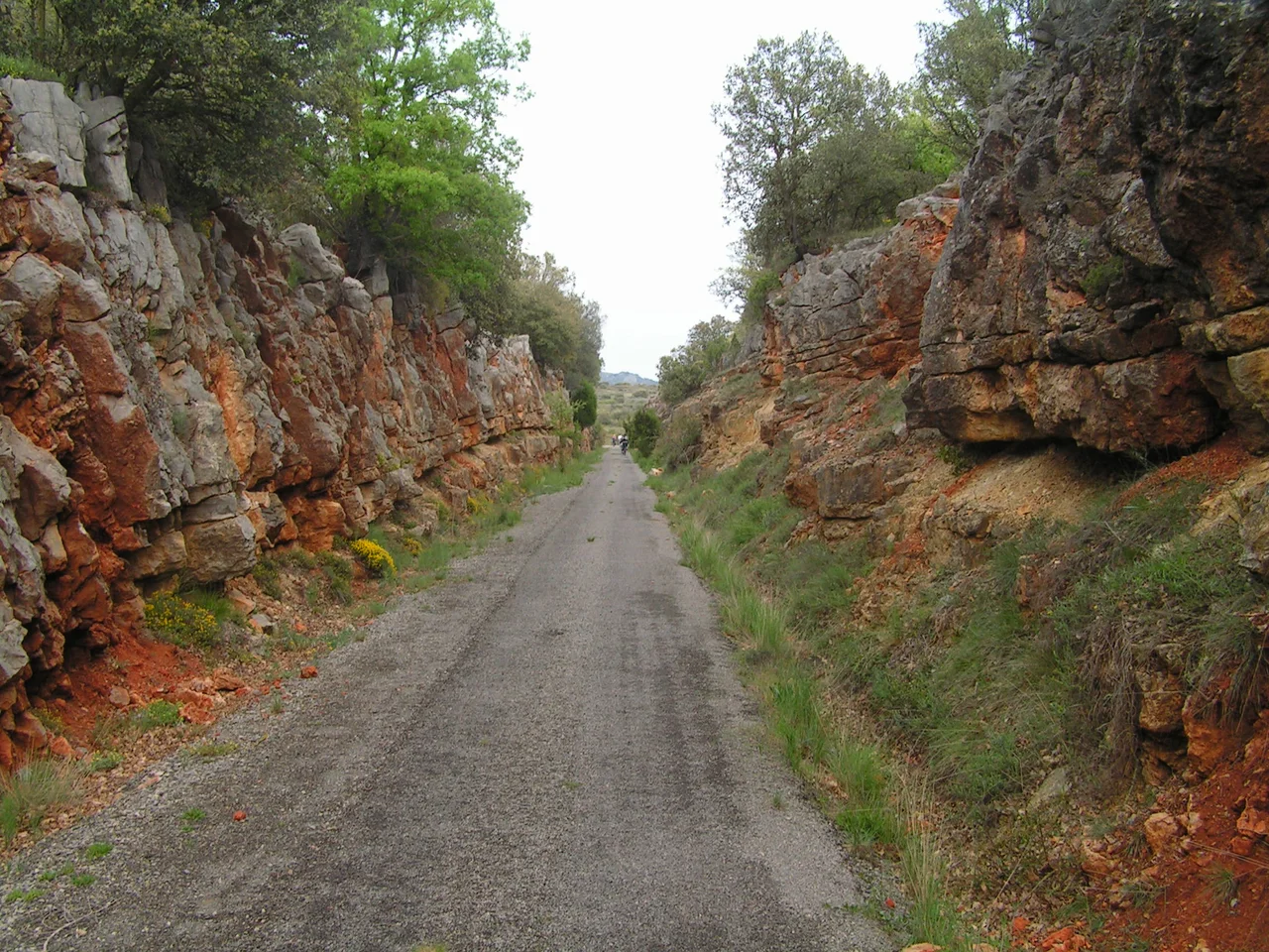

Vía Verde de Ojos Negros
For most of the twentieth century, this line existed to move one thing: iron. Ore trains rumbled down from the mines of Ojos Negros in the mountains of Teruel, crossing plateaus and passes and descending nearly a kilometre to the sea at Sagunto, where the metal was smelted and shipped. When it was built in 1903, the route ran some 200 kilometres and was the longest privately owned railway line in Europe. The trains stopped in 1972, the mining company went bankrupt in 1987, and the rails were pulled up. But the corridor they left behind has found an unlikely second life.
An Iron Road to the Sea
The story begins with money and rock. Late in the nineteenth century, rights to the rich iron deposits at Ojos Negros were granted to a group of Basque businessmen, who founded the Compañía Minera de Sierra Menera in 1900. The quality of the ore was excellent and the quantity vast, but the existing Teruel–Sagunto railway would not carry it on acceptable terms. So the company simply built its own line - a narrow-gauge railway running all the way to the Mediterranean coast, engineered to bear the relentless weight of loaded ore wagons. For seven decades it did exactly that, until changing economics finally shut it down and the Sierra Menera company collapsed.
The Longest Greenway in Spain
In 2001 the Valencian regional government began converting its share of the abandoned line into a rail trail, and Aragon soon did the same for the stretch within its borders. The result is the Vía Verde de Ojos Negros, at 160 kilometres the longest greenway in Spain and part of a national 'Vía Verde' network of some 2,700 kilometres built on disused railways. Plans have long been discussed to extend it right into the city of Valencia. What was once a private industrial artery, closed to everyone but the mining company, is now open to anyone with a bicycle, a pair of boots, or a horse.
From Sea to Plateau
Because it was engineered for heavily laden trains, the trail climbs with the patience of a railway, never steeper than a gentle 3 to 5 percent. It divides into two great stages. The first, Ojos Negros I, runs about 70 kilometres inland from Algimia d'Alfara in Valencia up to Barracas, rising some 800 metres from the Mediterranean plain to the edge of the central plateau through 15 old railway tunnels and across eight bridges. The second, Ojos Negros II, continues 91 kilometres from Barracas to Santa Eulalia del Campo in Teruel, crossing 13 viaducts and topping out at the Escandón Pass, 1,218 metres above sea level. Along the way it passes Sarrión, known as the truffle capital of the world.
Towns Along the Line
A rail grade makes a superb sightseeing route, because railways were laid to link places worth reaching. The Ojos Negros greenway threads together a string of them: Segorbe, with its cathedral and medieval walls; Jérica, crowned by a Mudéjar bell tower declared a national monument; and the extraordinary provincial city of Teruel, itself famous for Mudéjar architecture. The corridor also brushes past dozens of protected natural areas, among them the wooded ridges of the Sierra Calderona and the Sierra del Espadán, so a single day's ride can carry you from cathedral squares to pine and oak forest without ever facing a serious hill.
Riding the Grade
The gentle railway gradient makes the whole route accessible - to families, to older riders, and to people with disabilities, who can travel long stretches that a normal mountain trail would put out of reach. Weather is the main thing to plan around. The Valencian coast is hot and dry in summer, while up on the Teruel plateau winters bring sub-zero cold and snow, so spring and autumn are the ideal seasons to travel the full length. To ride it end to end is to retrace, in reverse, the journey the ore once made - climbing from the warm Mediterranean up through tunnels and viaducts to the high, cold country where the iron was dug, on a road that industry built and left behind for everyone else.
From the Air
The greenway runs roughly northwest–southeast for 160 km between Santa Eulalia del Campo in Teruel and Algimia d'Alfara near the Valencian coast; the coordinates here, 40.024°N, 0.714°W, sit on its middle reaches near Segorbe and Jérica. From the air, trace the long, straight-curved corridor of the former railway as it follows river valleys and passes through the Sierra Calderona and Sierra de Javalambre, its old tunnels and viaducts marking the line. The coastal end descends toward Sagunto and the port north of Valencia. Nearest airport is Valencia (LEVC) to the south, with Alicante–Elche (LEAL) and Murcia (LEMI) farther south. A viewing altitude of 3,000–6,000 ft lets you follow the corridor through its mountain valleys; the inland plateau air is clear and dry, though winter can bring snow over the higher stretches.
Nearby Stories
- Sagunto 8.1 km away
- Teruel 19 km away
- La Vall d'Uixó 21 km away
- Llíria 27 km away
- Catí 40 km away
- Castle of Alarcon 61 km away
- Cuenca Cathedral 62 km away
- Castle of Zorita de los Canes 126 km away