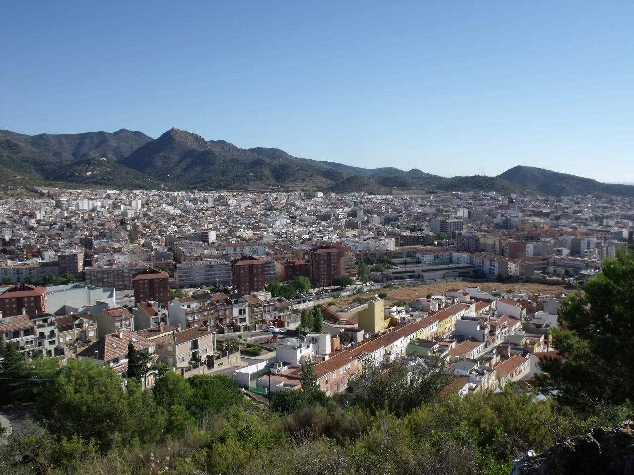

La Vall d'Uixó
You buy a ticket, step into a flat-bottomed boat, and float straight into the side of a mountain. Beneath La Vall d'Uixó runs the largest navigable underground river in Europe - the Coves de Sant Josep, a flooded limestone gallery where a boatman guides you through chambers hung with stalactites, past walls that people painted thousands of years ago. Above ground, this town in the province of Castellón looks unremarkable: orange groves, footwear workshops, two old church towers. Its most extraordinary feature is the water it sits on top of.
The River Inside the Mountain
The Coves de Sant Josep are the reason people come. The subterranean river carves through the rock for a considerable distance, and much of it is deep enough to travel by boat, poled and hauled along by guides who know every low ceiling by heart. Passengers duck beneath overhangs, glide across black water, and emerge into vaulted chambers where the limestone glistens. Near the mouth of the cave, prehistoric hands left paintings on the stone, a reminder that this cool, echoing place has drawn humans since long before the town above existed. It is one of those rare attractions that is exactly as strange as it sounds: a river you ride through the dark inside a hill.
Two Villages That Became One
La Vall d'Uixó is really two old towns that grew into each other. One is El poble de Baix, the lower village, gathered around the Assumpció church; the other is El poble de Dalt, the upper village, centred on the Àngel church. Each kept its own historic street plan as they merged, so the modern town still carries the fault line of its double origin. Wander the lanes and you can feel the seam - two hearts beating under one name, each with its own church, its own square, its own memory of having once been a place unto itself. Neither village surrendered its identity in the merger; they simply agreed to share a map.
Layers Underfoot
Dig anywhere here and history surfaces. On the hills sit the remains of the Iberian city of Punta Orley, its ancient name lost, its stone walls and public buildings raised in overlapping eras. In the Unió neighbourhood, archaeologists opened a Hispano-Visigothic necropolis and found eight graves holding sixty-six people who lived in the sixth and seventh centuries AD. The Romans left aqueducts near El Roser; the twelfth-century Torre de Benizahat still stands from the town's Muslim period. Few places of this size hold so many chapters at once - Iberian, Roman, Visigothic, Islamic, and Christian, stacked within a few square kilometres of hillside and plain.
Shoes, Oranges, and a Tennis Champion
The modern town was built in the middle of the last century, when La Vall d'Uixó shifted from dry farming to irrigated citrus and grew a genuine industry around footwear and leather. It works for a living, and it celebrates hard too: since 1982, Les Penyes en Festes has filled the first week of August with music and street revelry, alongside the springtime Falles. The town also punches above its weight in sport. It sent José Vicente Arzó home with a Paralympic silver in 2008, and it raised Sara Sorribes Tormo, the professional tennis player who learned the game on these courts before carrying the town's name onto the world tour.
A Table Worth Sitting At
Like everywhere in the Valencian Community, the kitchen here runs on rice. Paella appears on tables every Sunday, but La Vall guards a few dishes of its own. There is arròs al forn, a hearty oven-baked rice of ribs, sausage, and chickpeas; empedrao, an old hunters' stew thick with beans and game; and panets, sweet cakes pressed from figs and almonds in a mould made for the purpose. It is honest, unshowy food, built for festival tables and long lunches rather than for show. Between a boat ride through an underground river, a walk between two old church squares, and a plate of oven-baked rice, La Vall d'Uixó offers a visitor far more than a town of its size has any obligation to.
From the Air
La Vall d'Uixó sits at 39.82°N, 0.23°W, inland on the Castellón plain between Sagunto and Castellón, at the foot of the Serra d'Espadà foothills. From the air the town spreads across the valley floor with the wooded hills rising immediately to the west; the Coves de Sant Josep open into the hillside on the town's edge. Castellón-Costa Azahar (LECN) is the nearest field, just north; Valencia's LEVC lies about 40 km south, and Alicante-Elche LEAL is farther down the coast. A viewing altitude of 2,500-4,500 ft AGL frames the town against the sierra. Visibility is typically good, with afternoon cloud possible over the higher ground inland.
Nearby Stories
- La Tomatina 16 km away
- El Cabanyal 16 km away
- Desert de les Palmes Natural Park 18 km away
- Vía Verde de Ojos Negros 23 km away
- Illa Grossa 30 km away
- Peniscola Castle 32 km away
- Dinópolis 43 km away
- Illa Conillera 97 km away