
Rago National Park
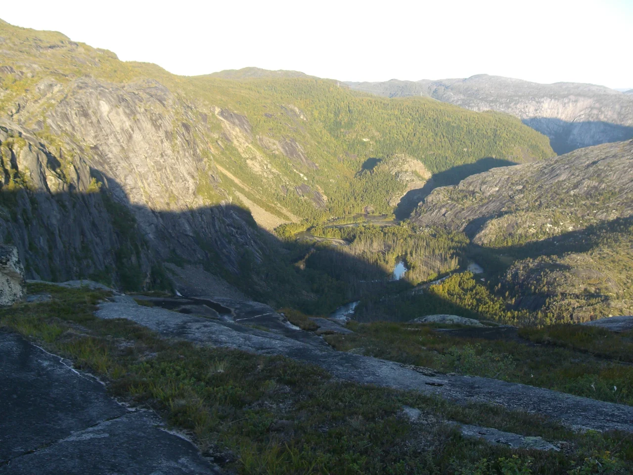
The name is a warning. Rago comes from the Sami Rákkok, which translates to something close to 'difficult and impassable mountain region,' and the park carries the name of the mountain that carries the word, over on the Swedish border. Nothing about the place since 1971 has made the description inaccurate. Norway protected 171 square kilometres here by royal resolution on 22 January of that year, on the east side of the E6 about ten kilometres northeast of Straumen, and what it protected was not a scenic set piece but a piece of ground that had defeated most attempts to make anything of it.
Bone-Polished Rock
What strikes you first is how naked it all is. The ice sheets scoured this bedrock smooth and then left it, so whole hillsides read as bare grey domes, glossy where meltwater still runs over them, littered with granite boulders dropped exactly where the ice happened to be when it stopped. Soil is thin and poor. The climate is harsh even by Nordland standards. Between them they hold the plant life down to a short list — pine on the lower slopes, alpine species scattered through the woods and above them, and not much else. Several small glaciers survive in the southeastern corner. There is nothing lush here, and the effect is the opposite of bleak: with so little vegetation to soften it, the shape of the landscape itself is exposed, every fold and scratch of the last glaciation still legible.
Down Storskogdalen
One marked route runs northeast into the heart of the park, up the valley called Storskogdalen, with the Nordfjordelva below and pine-covered slopes rising into vertical cliff faces on either side. Beyond Storskogvatnet the valley changes character and name, becoming Trolldalen. The water is the show. Litlverivassforsen drops 223 metres out of the lake Litlverivatnet into Storskogdalen — a fall of a scale you would expect to find on a tourist itinerary rather than at the end of a day's walk from the nearest road. Along Storskogelva there are three more worth stopping for: Klipforsen, Storforsen, Helligforsen. In late spring, when the snowfields let go all at once, the whole valley is loud.
Five Cabins and a Tent
The park's entire built infrastructure amounts to five huts. Two stand at Storskogvatnet, one at the eastern end of Litlverivatnet, one is a reindeer herder's cabin at Ragovatnan, and one sits near the Swedish border. Bunk space is limited enough that walkers are advised to bring a tent regardless of what the map promises. That thinness of provision is deliberate and it defines the experience: Rago is not a park you visit so much as one you cross, and it rewards people who arrive self-sufficient. The reindeer cabin is a reminder of who was working this country long before it was designated — Sami herders, whose semi-domesticated animals still move through the park on ranges that predate every line drawn on the map.
Who Else Is Here
Rago's animal life is as short a list as its plant life, and for the same reasons. Moose come up into the valleys. Semi-domesticated reindeer graze the higher ground. Wolverines hold territory here, which says a good deal about how little the place is disturbed — the wolverine is the animal that tends to survive precisely where people find travel difficult. Willow grouse are common, and golden eagles are seen often enough to be expected rather than remarkable. Brown bears used to be part of this fauna and were still numerous in the Swedish parks across the border, but they have not been regular residents on the Norwegian side since around 1900. Their absence is the one hole in an otherwise intact northern ecosystem.
A Border That Isn't One
For a park of 171 square kilometres, Rago punches far above its area, because of what lies immediately east of it. On the Swedish side it abuts Padjelanta, and beyond Padjelanta lie Sarek and Stora Sjöfallet. Taken together the block of protected land runs to something over 5,000 square kilometres of continuous wilderness — one of the largest such areas anywhere in Europe. The national frontier runs straight through the middle of it and means nothing at all to the wolverines, the eagles, the meltwater, or the herds. Rago is the Norwegian doorway into that country, and the smallest, hardest, least-visited part of it.
From the Air
Rago National Park is centred near 67.43°N, 15.98°E, east of the E6 and roughly 10 kilometres northeast of Straumen in Sørfold. From 7,000 to 11,000 feet the park reads as a band of glacier-scoured grey bedrock between the fjord country to the west and the Swedish high plateau to the east. Key visual anchors are the lakes Storskogvatnet and Litlverivatnet, the Storskogdalen valley running northeast, and the small glaciers in the southeastern corner. Continue east and the terrain opens into Padjelanta, Sarek and Stora Sjöfallet. Nearest airport is Bodø (ENBO), about 70 kilometres southwest; Harstad/Narvik Evenes (ENEV) lies north and Gällivare (ESNG) east across the border. Weather changes fast over the divide, and valley cloud can fill Storskogdalen while the surrounding tops stay clear.
Nearby Stories
- Sulitjelma Hotel 1.1 km away
- Blood Road Museum 5.5 km away
- Árran Lule Sámi Centre 42 km away
- Saltstraumen 42 km away
- Laponia 46 km away
- Kungsleden 56 km away
- Lofoten Fishery 58 km away
- HMS Hardy (H87) 85 km away