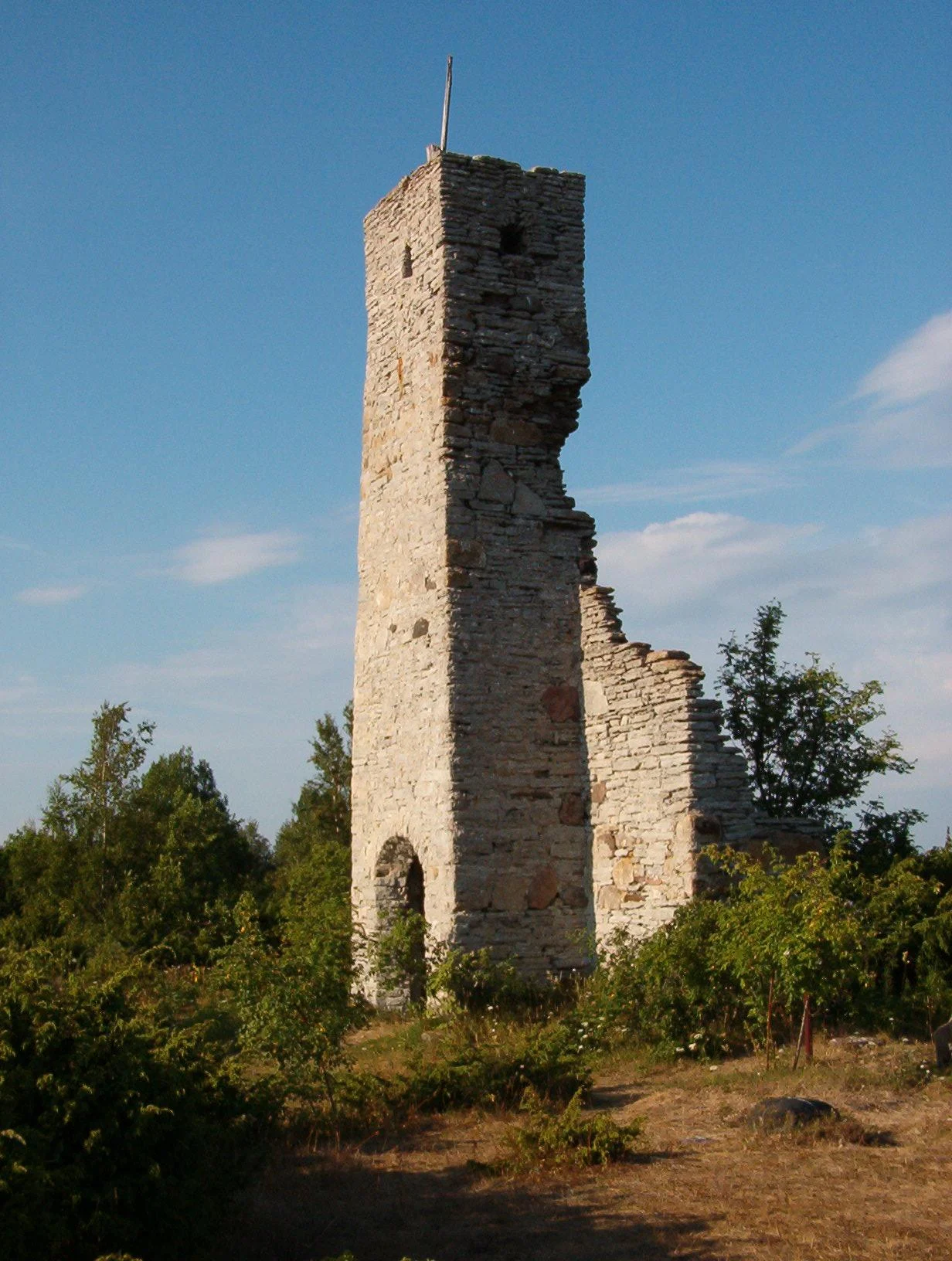

Osmussaar Chapel
Brus. Greis. Nibondas. Marks. Erkas. Nigards. Stavas. Seven family names carried the whole population of Osmussaar for generations, and a plate fixed to the wall of the island's ruined chapel records the seven families who were forced to leave on 12 June 1940. The building that holds the plate has no roof. Its facade and tower still stand - limestone, weathered pale, open to the Baltic sky - and around them lies the cemetery where those families buried their dead for as long as anyone kept count. It is not a large ruin. It is roughly twelve metres by seven, with a tower about five metres high. But it is the last address of a community that had been on this island since at least 1250.
The Chapel That Moved Without Being Moved
The first chapel here was wooden, put up in the 16th century right at the island's harbour, where a congregation of fishermen would naturally want it. It is now a kilometre and a half inland from that harbour, and nobody carried it anywhere. Osmussaar is rising. Freed of the weight of the last ice sheet, the whole crust here rebounds by about three millimetres a year - a rate too slow to notice in a lifetime and impossible to ignore across five hundred of them. On an island this flat, a metre or so of uplift does not raise a hill; it pushes the shoreline sideways, hundreds of metres at a time. The sea simply walked away from the church door and kept going.
Limestone, 1766
The stone replacement was consecrated on 3 September 1766, built from the Ordovician limestone the island is made of. Osmussaar is essentially a slab of that rock lifted out of the sea, its edges breaking into low cliffs, and the chapel is the island talking to itself - the same grey stone underfoot, in the wall, and on the graves. The Swedes called it Jesu Kapell; in Estonian it is Jeesuse kabel. Roughly 130 people lived here in the 1930s, of whom 119 were Estonian Swedes, and a chapel of twelve by seven metres was sized precisely for them. They fished, hunted seal, farmed a little in the thin soil, and paid their taxes to an estate on the mainland near Haapsalu.
A Luther Salvaged from a Wreck
In 1852 the islanders mounted a figure of Martin Luther reading his Bible at the chapel gate. It had not been carved for a church. It was a ship's figurehead, taken from a British vessel wrecked off the island - and wrecks were part of how Osmussaar lived. The island sits in the mouth of the Gulf of Finland, directly in the path of everything sailing toward Tallinn and St Petersburg, and what the sea broke on its shoals, the islanders salvaged. There is something entirely characteristic in the result: a carved man made to stare down open water from a bow, repurposed to stand at a graveyard gate and look, presumably, at the same horizon. In the summer of 1905 the Swedish writer Albert Engstrom came out here with the painters Anders Zorn and Akseli Gallen-Kallela and wrote the place up for a Stockholm magazine. It was already, then, the kind of island people travelled to in order to see something that felt older than they were.
12 June 1940
That summer the Soviet Union, operating under the bases agreement it had pressed on Estonia the previous autumn, ordered every resident of Osmussaar off the island so it could be fortified. They were taken to Vormsi, another Estonian Swedish island to the south, and the sea walls of their own home became a coastal artillery position with heavy batteries and a fire-control tower. Families whose names are documented on this rock since the 13th century packed what they could carry and went. Most never lived here again; within a few years the wider Estonian Swedish population had scattered to Sweden, and the Osmussaar community effectively ended as a place-based thing and continued only as a memory held by people living somewhere else. The chapel itself was wrecked in the fighting that followed. What survived is the facade and the tower.
Coming Back to a Ruin
The former inhabitants and their descendants did come back, though not to stay. In 1994, three years after Estonia regained independence and a year after the last Soviet troops left the island, they built and consecrated a new belfry beside the ruin - a bell for a church that no longer has walls to hang it in. The remnants of the chapel were conserved in 2011, and in 2014 the chapel and cemetery together were listed as a national heritage site. Roughly five people live on Osmussaar year-round now, and up to three thousand visitors come out in a summer. Most of them walk to the chapel. The plate on the wall is metal these days; the wooden original did not last. Seven names, one date, and a great deal of sky.
From the Air
Chapel and cemetery at approximately 59.289 N, 23.401 E, near the middle of Osmussaar's western side, Laane County, Estonia. The island lies 7.5 km off the Estonian mainland at the mouth of the Gulf of Finland: a flat limestone slab about 5 km long and 1.3 km wide, easy to identify from 2,000-4,000 ft by its low bright cliffs and the black-and-white banded lighthouse at the northwestern tip. The chapel ruin reads as a small pale rectangle roughly 1.5 km inland from the old southern harbour, beside Lake Kappelkarre. Nearest airfields: Amari (EEEI) about 45 km southeast, Tallinn Lennart Meri (EETN) about 80 km east, Kardla (EEKA) about 60 km southwest. The whole island is a landscape protection area established in 1996, so keep altitude and avoid low passes during spring and autumn bird migration.
Nearby Stories
- Russian cruiser Pallada (1906) 2.8 km away
- Haapsalu Castle 16 km away
- Padise Abbey 17 km away
- Finnish minelayer Louhi 19 km away
- Koluvere Castle 21 km away
- Hitis 66 km away
- Saaremaa 75 km away
- Military Museum of Finland 87 km away